
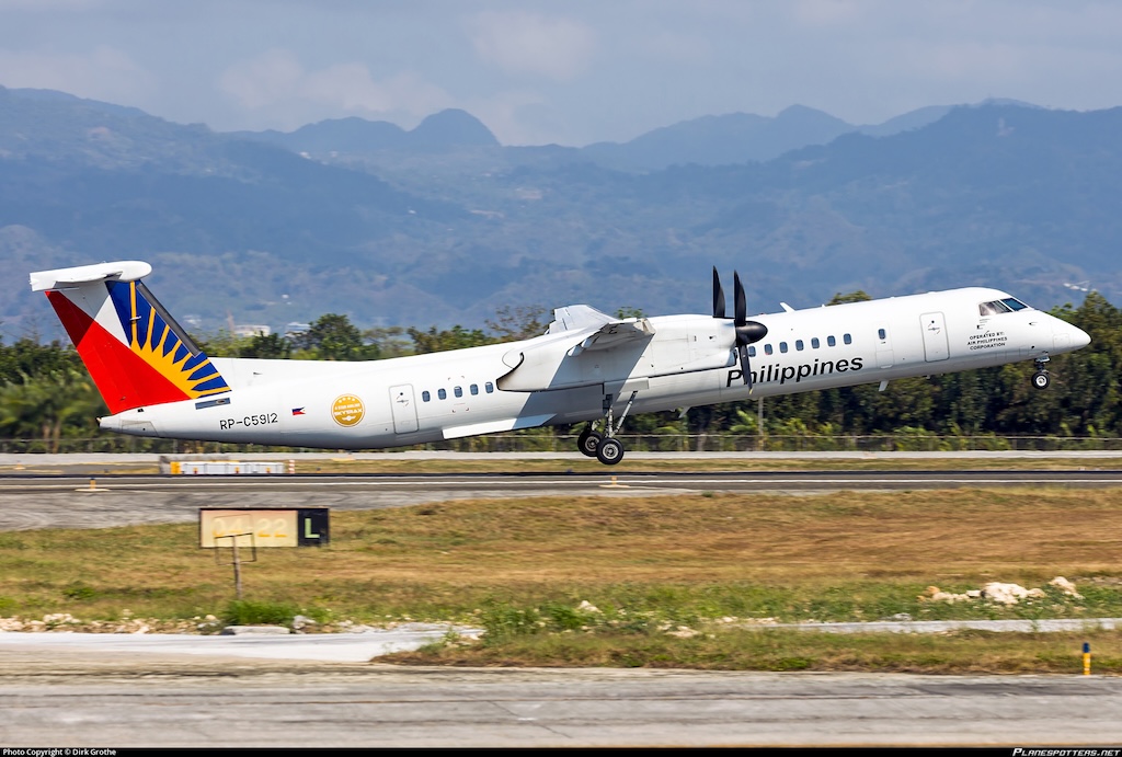
Online discussions surrounding the missed approach of Philippine Airlines (PAL) Express Flight PR2679 at Clark International Airport (CRK) on 23 May 2026 have fueled speculation, but much of the narrative appears to be based almost entirely on interpretations of publicly available flight tracking data rather than verified operational evidence. The De Havilland Canada Dash 8-400 (RP-C5912) operating the flight from Busuanga (USU) to Clark (CRK) later diverted safely to Manila (MNL) after adverse weather affected operations in the Angeles, Pampanga area.
A key issue with the claims of an online news website is the heavy reliance on data from Flightradar24. While widely used by aviation enthusiasts and the general public, flight tracking platforms are not intended to serve as definitive tools for analyzing aircraft performance during dynamic flight situations. ADS-B-based systems can produce inaccurate altitude readings, erratic climb or descent rates, delayed updates, and positional inconsistencies, particularly during low-altitude maneuvering, severe weather encounters, or rapid changes in aircraft attitude. Aviation analysts have repeatedly cautioned against treating such data as equivalent to official flight recorder information, cockpit instrumentation, or air traffic control radar records.
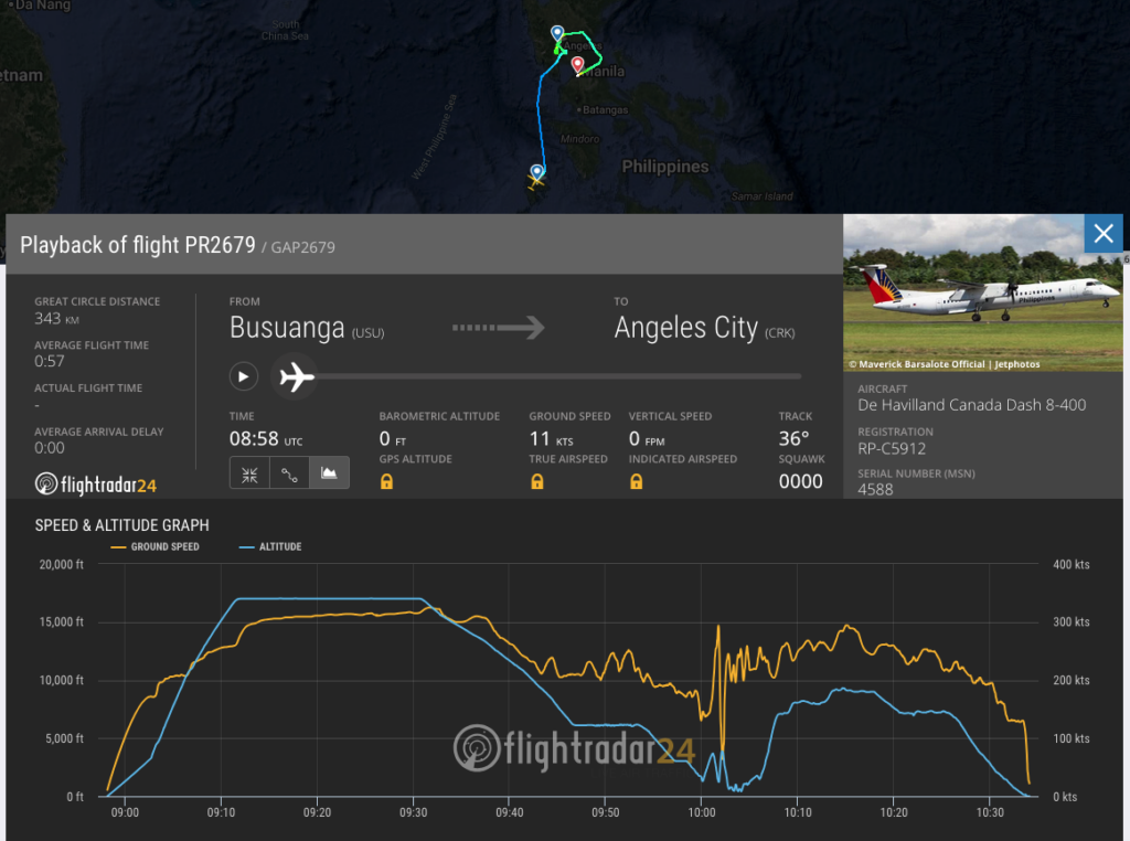
Based on our own analysis of the graph circulating online, what many are describing as a “rapid drop” appears far more consistent with a textbook Flightradar24 telemetry glitch than an actual aerodynamic stall or loss-of-control event. An aerodynamic stall occurs when an aircraft loses too much airspeed, and its wings can no longer generate sufficient lift, resulting in a rapid and unstable loss of altitude. However, the graph being shared tells a very different story. Past 1000 UTC, the yellow line representing ground speed suddenly collapses to near-zero before violently spiking back up, while the blue altitude line continues descending in a smooth and gradual manner. In real-world physics, a commercial aircraft cannot instantly drop to near-zero speed mid-air while simultaneously maintaining a stable descent profile. Had the aircraft truly lost that much speed, the altitude trace would have shown a catastrophic plunge rather than a controlled slope.
What the graph actually suggests is a temporary telemetry interruption — something that is highly common on public tracking platforms during low-altitude turns and maneuvering. The flight path itself shows PR2679 performing holding patterns over the Clark area, likely due to unfavorable weather or traffic sequencing. During sharp turns at lower altitudes, an aircraft’s transponder can briefly lose optimal line-of-sight with ground-based receivers feeding data into Flightradar24. When this happens, the tracking platform may momentarily interpret missing or incomplete telemetry as a dramatic speed drop or erratic vertical movement before reconnecting and normalizing the data stream. This creates misleading spikes and anomalies on the public graph that do not necessarily reflect the aircraft’s actual performance.
Equally notable is the absence of verified firsthand accounts describing a near-disaster onboard the flight. Publicly visible social media discussions from passengers mainly referenced the diversion to Manila and the inconvenience it caused, but we have not seen any credible passenger posts describing panic, loss of control, or a life-threatening situation during the approach sequence. This sharply contrasts with the alarming tone adopted by some online reports that attempted to portray the event as an extraordinary aviation emergency.
Weather-related go-arounds, holding patterns, and diversions are routine occurrences in commercial aviation, especially during periods of unstable atmospheric conditions. Without access to official cockpit data, weather radar information, ATC recordings, or findings from aviation authorities, conclusions drawn solely from consumer-grade tracking platforms remain speculative at best. Responsible reporting requires careful distinction between verified facts and assumptions derived from incomplete public telemetry data, especially for individuals who do not possess the technical knowledge, aviation background, or operational experience necessary to accurately interpret flight tracking information and aircraft behavior during abnormal weather conditions or missed approach procedures.